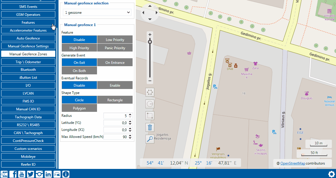
File:Drawing a Rectangle Geofence.gif
From Wiki Knowledge Base | Teltonika GPS
Size of this preview: 800 × 426 pixels. Other resolutions: 320 × 170 pixels | 1,143 × 608 pixels.
Original file (1,143 × 608 pixels, file size: 306 KB, MIME type: image/gif, looped, 118 frames, 17 s)
Note: Due to technical limitations, thumbnails of high resolution GIF images such as this one will not be animated.
Drawing Rectangle Geofence
File history
Click on a date/time to view the file as it appeared at that time.
| Date/Time | Thumbnail | Dimensions | User | Comment | |
|---|---|---|---|---|---|
| current | 05:17, 29 April 2020 | | 1,143 × 608 (306 KB) | Svelazquez (talk | contribs) |
You cannot overwrite this file.
File usage
The following 13 pages use this file:
- FMB640 Manual Geofence zones
- FMB641 Manual Geofence zones
- FMC640 Manual Geofence settings
- FMC640 Manual Geofence zones
- FMC650 Manual Geofence settings
- FMC650 Manual Geofence zones
- FMM640 Manual Geofence settings
- FMM640 Manual Geofence zones
- FMM650 Manual Geofence settings
- FMM650 Manual Geofence zones
- Template:FMC640 Manual Geofence settings
- Template:FMM640 Manual Geofence settings
- Template:FMX640 Manual Geofence zones

