ISO6709: Difference between revisions
Appearance
Created page with "'''ISO 6709''' ''Standard representation of geographic point location by coordinates'' is the international standard for representation of latitude, longitude and altitude for..." |
No edit summary |
||
| Line 8: | Line 8: | ||
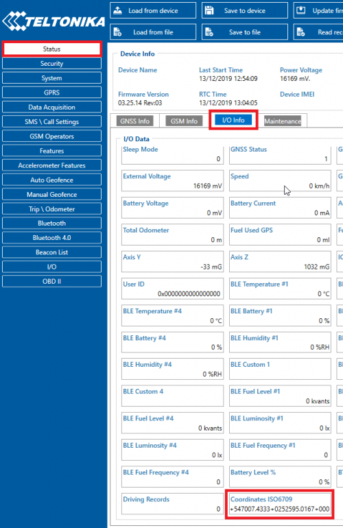
The required parameter is showed as the I/O element in the Configurator. | The required parameter is showed as the I/O element in the Configurator. | ||
[[Image:ISO 6709 standart gps data.png|500px|none]] | |||
<br /> | <br /> | ||
Revision as of 13:15, 13 December 2019
ISO 6709 Standard representation of geographic point location by coordinates is the international standard for representation of latitude, longitude and altitude for geographic point locations.
Buffer with ISO 6709 standard GPS data will be updated every second.
Function to take 3 arguments (latitude, longitude, altitude) and output ISO 6709 format (ex: +27.5916+086.5640+8850).
New IO element will be available with Codec 8 Extended only.
The required parameter is showed as the I/O element in the Configurator.

