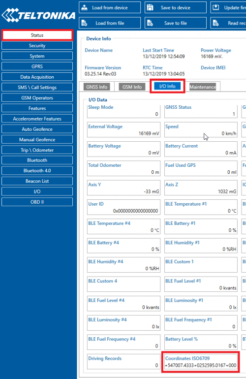
ISO6709
ISO 6709 Standard representation of geographic point location by coordinates is the international standard for representation of latitude, longitude and altitude for geographic point locations.
Buffer with ISO 6709 standard GPS data will be updated every second.
Function to take 3 arguments (latitude, longitude, altitude) and output ISO 6709 format (ex: +27.5916+086.5640+8850).
The required parameter is showed as the I/O element in the Configurator.
This parameter will also be send as the separate I/O element via AVL Data ID 387.
New IO element will be available with Codec 8 Extended only.
Below, there is listed AVL data package received, with IO element ISO 6709 enabled.
Received data in hexadecimal stream:
00000000000004C08E160000016F7B19C394000F0E57D9209AB9C8008A00230B000000000004000100FA01000200B500050042358B000100100000028E000000000000016F7B1A3865000F0E57D9209AB9C8008A002307000000000004000100FA01000200B500070042358B000100100000028E0000000000000
Parsed data:
| AVL Data Packet | ||
|---|---|---|
| AVL Data Packet Part | HEX Code Part | |
| Zero Bytes | 00 00 00 00 | |
| Data Field Length | 00 00 00 4A | |
| Codec ID | 8E | |
| Number of Data 1 (Records) | 01 | |
| AVL Data | Timestamp | 00 00 01 6B 41 2C EE 00 (GMT: Monday, June 10, 2019 11:36:32 AM) |
| Priority | 01 | |
| Longitude | 00 00 00 00 | |
| Latitude | 00 00 00 00 | |
| Altitude | 00 00 | |
| Angle | 00 00 | |
| Satellites | 00 | |
| Speed | 00 00 | |
| Event IO ID | 00 01 | |
| N of Total ID | 00 05 | |
| N1 of One Byte IO | 00 01 | |
| 1’st IO ID | 00 01 (AVL ID: 1, Name: DIN1) | |
| 1’st IO Value | 01 | |
| N2 of Two Bytes IO | 00 01 | |
| 1’st IO ID | 00 11 (AVL ID: 17, Name: Axis X) | |
| 1’st IO Value | 00 1D | |
| N4 of Two Bytes IO | 00 01 | |
| 1’st IO ID | 00 10 (AVL ID: 16, Name: Total Odometer) | |
| 1’st IO Value | 01 5E 2C 88 | |
| N8 of Two Bytes IO | 00 02 | |
| 1’st IO ID | 00 0B (AVL ID: 11, Name: ICCID1) | |
| 1’st IO Value | 00 00 00 00 35 44 C8 7A | |
| 2’nd IO ID | 00 0E (AVL ID: 14, Name: ICCID2) | |
| 2’nd IO Value | 00 00 00 00 1D D7 E0 6A | |
| NX of X Byte IO | 00 00 | |
| Number of Data 2 (Number of Total Records) | 01 | |
| CRC-16 | 00 00 29 94 | |
Server response: 00000001
