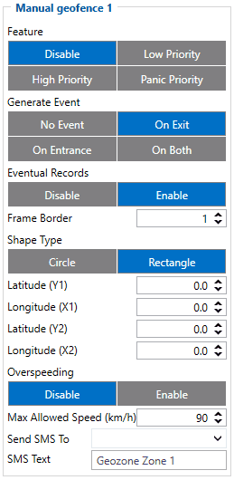
GH5200 can have up to 50 configurable Geofence zones. As well Geozones can generate an event when a defined zone border is crossed.
Manual Geofence Settings
Feature - The priority of Geofence event is categorized into Low, High or Panic levels. These levels define the priority of event information that is sent to the server. For more details about priorities look in here.
Generate event allows to choose when record will be generated.
Eventual records - controls where scenario status value appears: when disabled it will exist in each AVL record and when enabled the value will be appended only to eventual records.
Frame border - is an additional border around Geofence zone used to prevent false events when object stops on the border of the area and as a result records are made inside and outside the defined area because of GNSS errors. The event is generated only when both (Geofence and frame) borders are crossed. See figure to the right for details. Blue track is considered to have entered the area whereas red track is not.
Shape type - it is possible to have a rectangle or a circle as it is defined by the user.
Radius - is used to set circle radius in meters when Circular zone is used.
Latitude Y1 - is used to set Y coordinate (latitude).
Longitude X1 - is used to set geofence zone left bottom corner X coordinate (longitude).
Latitude Y2 - is used to set geofence zone upper right corner Y coordinate (latitude) for a Rectangular zone.
Longitude X2 - is used to set accordingly geofence zone upper right corner X coordinate (longitude) when Rectangular zone is used or circle radius when Circular zone is used.
Over Speeding - helps to configure Over Speeding scenarios separately for each different Geozone. If digital output control is enabled in a regular OverSpeeding scenario, geozones' OverSpeeding scenario will control it too i.e when the device is in more than one geozone and OverSpeeding is detected in any zone then the digital output turns on. Digital output turns off only when OverSpeeding is not detected anywhere.
Note! Regular OverSpeeding and geozones' OverSpeeding function independently.
Max Allowed Speed - Max allowed speed in the geozone.
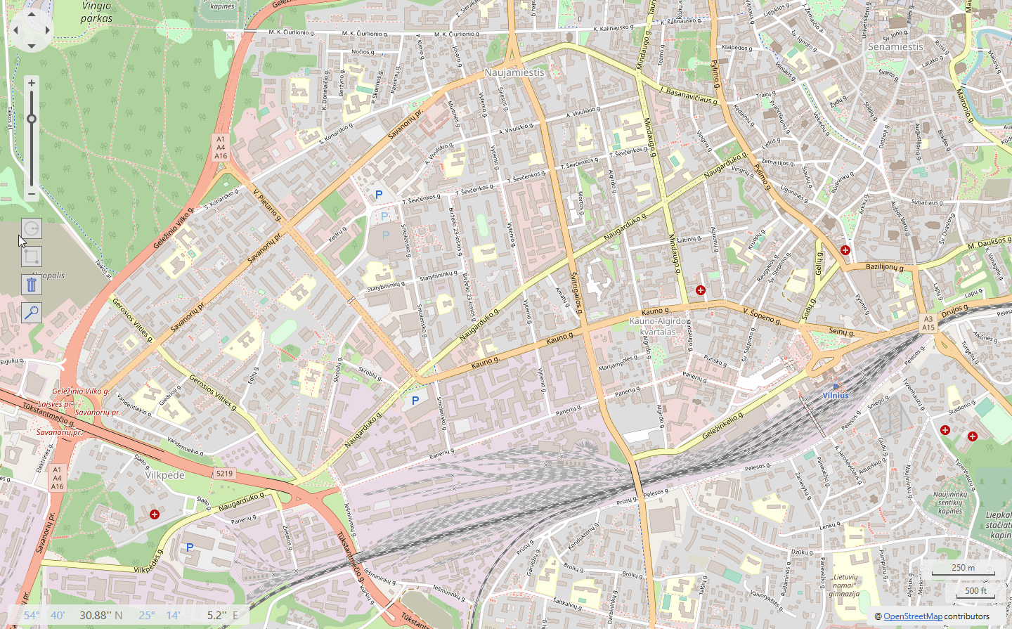
Manual Geofence Map
Coordinaces for the Geozone can be described not only with coordinate system but by drag & drop principle on the map in each selected geozone. Note! Only one figure can be set on one geozone.